
|
Enhanced Water Quality Project: Data Collection Procedures and Modeling
Tiffany Trent, A.R.M. Loxahatchee NWR, 2006
(This page provides a summary of the poster which may be downloaded by clicking HERE)
Background
In 2004 Congress authorized funding to the Arthur R. Marshall Loxahatchee National Wildlife Refuge (Refuge) to establish an Enhanced Water Quality Monitoring and Modeling Program. This program is completing its second year, and involves several areas of study, including:
- Increasing the extent of the monthly water quality sampling stations to encompass the outer perimeter of the Refuge
- Continuous monitoring of canal water intrusion potential by using Hydrolabs (Figure 2) and YSIs to measure conductivity along transects
- Development and application of hydrodynamic and water quality modeling tools for the Refuge
Objectives
The primary objectives of this program is to monitor and understand relationships between structure operations and water movement into and out of the perimeter canal, the extent of water movement into the interior of the marsh, and the relationship between canal/marsh water movement and the water quality of the interior marsh.
| Monthly Water Quality Sampling: | Each month grab samples are taken from permanent sites located in the outer perimeter of the Refuge wetland (Figure 1). These samples are processed for a number of water quality parameters including total phosphorus, Cl, DOC, and SO4. Additionally, a multiprobe sonde is also taken to each sampling location to measure instantaneous specific conductivity, temperature, pH, and dissolved oxygen. |
| Continuous Monitoring Transects: | Seven monitoring transects have been strategically placed at various areas of the marsh (Figure 4) which continually measure specific conductivity and temperature (Figure 3). |
| Modeling: | The goal of the modeling program is to provide tools for Refuge planning and management decisions related to water control operations, water supply, and water quality. These model tools should assist in answering management questions. |
Figure 1 |
| Refuge map showing monthly water quality sampling sites in the Refuge. [larger image] |
Links to Management Questions
Results will allow us to understand structure operations and water movement into and out of the perimeter canal, canal water movement into the interior of the marsh, and relationship of water quality and ecology of the marsh interior. In understanding the relationships between water flow of structure operations, movement of water into marsh from the canal and understanding the ecological impacts of this water movement (see Figure 5), we can evaluate management actions to lessen the intrusion of nutrients including phosphorus into the Refuge to protect Refuge resources.
Specific management questions posed for this program include:
- What are the spatial and temporal distributions of phosphorus levels within the Refuge?
- What is the impact of different management scenarios on the water distribution inside the Refuge?
- What is the impact of the management scenarios on the hydroperiod?
- Does the water depth (duration and frequency) satisfy the needs of the plants and wildlife?
Figure 2 |
| A Hydrolab minisonde 4a, one of two types of instruments used in the sonde transects. [larger image] |
Figure 3 |
| The conductivity and temperature probes on the hydrolab minisonde. |
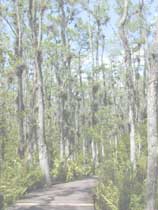
Figure 4 |
| Field Biologist Robert Smith deploying a Hydrolab minisonde in the canal. [larger image] |
Figure 5 |
| Changes in the Everglades flora and fauna begin to occur at total phosphorus concentrations slightly higher than 10 ppb. Cattails, which readily absorb phosphorus, push out native saw grass, wading birds, and fish, fill in open water areas, and lower dissolved oxygen rates. [larger image] |
Figure 6 |
| Examples of data from the continuous monitoring transects. [larger image] Graphs provided by Dr. Donatto Surratt, ARM Loxahatchee, NWR |
Example of Results to Date
Figure 6 presents specific conductance readings along a spatial gradient going from the perimeter canal into the interior marsh for 2 different months in 2005. The smooth line represents the exponential fit to spatial conductivity during periods when the marsh and canal stages were equal, net flow for the Refuge was zero, and rainfall was zero. The square represents the exponential fit to spatial conductivity for the identified months. The top graph shows a month where marsh water height exceeded that of canal water height (little or no canal water intrusion into the marsh), while the bottom graph shows a month where canal water height exceeded that of the interior marsh. As canal water height rises above that of interior marsh water, the specific conductance in the marsh water rises as well; first most drastically in locations close to the canal, and then to the less impacted extreme marsh interior. As the marsh wetland does not uptake (remove) specific conductance from the water, this transect information provides a way to track canal water intrusion.
References
No comments:
Post a Comment
Comments are welcome. Inappropriate, commercial, or offensive comments will of course be removed as quickly as possible.